Stein High Traverse
Posted: Mon May 16, 2016 11:35 pm
I seem to have a fascination with the Stein. It's by no intentions that I continuously visit the area. First I tried to run it in a day a few years ago, then we went back and hiked it with some side trips last summer in a 3 day suffer fest (17 + 12 + 12 hour days). So when Rich suggested that we go ski it in the fall my interest was piqued. Not having much information I did some Googling and mapsturbating and drew a line on a map on the internet and sent it over to Rich. His reply, "That's interesting." Apparently there's a "traditional route" in John Baldwin's book, but not possessing (nor having an interest in possessing) a copy of the book I just drew what looked best to me via shaded topo lines and satellite images. I wanted to summit and ski Skihist, which besides being the tallest mountain in SWBC at 2968m also has a very attractive NE face that's only been skied once or twice (when the North Kwoiek Creek road was still a road). Rich has a bad habit of saying yes to my plans despite the fact that he usually knows better, but it's likely because he wants to witness me suffering when my poorly researched plan starts to unravel.
I should also add that I was a little worried about my shoulder, as I dislocated the left one 7 weeks prior to the start of this trip. It was the first time for that side and I wanted to keep it that way.
Anyway, we started off the trip all the way down near Lillooet Lake on the Lizzie Creek FSR. Someone had carved out a new trail to bypass the washout and the shitty trail that had become the washout bypass. But the new trail quickly ended (who builds the entrance to a trail and puts up trail markers before finishing a trail?) and we descended some steep and bushy choss to gain the road. I had forgotten something at the car and had to run back without my pack, but no big deal. At least 70 pounds of gear made the road a slow slog. It also made us rather top heavy:

At some point we put our skis on and much to the surprise of no one my tele binding was already falling apart. Some swearing and bush followed

It took us 8 hours to get to the Lizzie cabin, compared to the 3 hours it took us with light packs and no skis in the summer. We pushed on towards Caltha lake and were rewarded with beautiful light on the up and breakable crust on the descent. Much fun was had.

Caltha Lake and our first camp with Petlush and Skihist way way off in the Distance

Day 2 we had a lot of distance to cover and were moving at sunrise. We contoured around into what from a distance looked like easy terrain, but instead was icy micro-terrain. We side hilled and boot packed our way over to Figure 8 Lake where we then traverssed the ridge towards Vanguard. Figure 8 Lake:
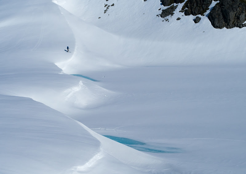
Vanguard:

We summitted Vanguard, which had a moderately steep summit slope that quickly mellowed, but then half way down the face rolled over towards a lake that used to be glacier. Not being sure of what was below the roll, we went around to a mellow gully on skiers left. Looking up, it was good we hadn't skied straight off. The steep part below the roll was a mix of rock slabs, glide cracks, and thin ribbons of isothermal mush. We crossed the lake and skinned up to a ridge where we found shelter from the heat behind a giant boulder. We took the time to have a siesta in order to allow the sun to have time to cook us even more on our next climb. We booted and skinned up the the ridge till we gained the remnants of the Skook Jim glacier, which allowed easy skinning to the ridge and then further along to the summit. Great views lead to fantastic corn turns back to our packs on the ridge where we dropped down and gaped at magnificient views of the Nahatlatch Range.
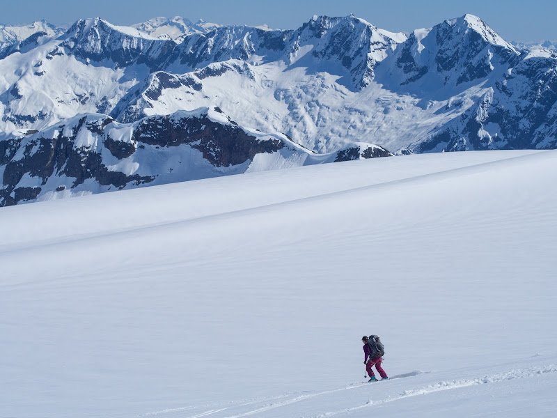
The best image to explain the next several hours is one from August. We traversed flat glaciers (from R to L) and climbed small bumps along the ridge to gain the summits of Crevasse Crag and Klackarpun.

The setting was hard to beat and the never ending view the Nahatlatch was amazing. Maddy skiing off of Klackarpun towards Elton Lake in the early evening light.
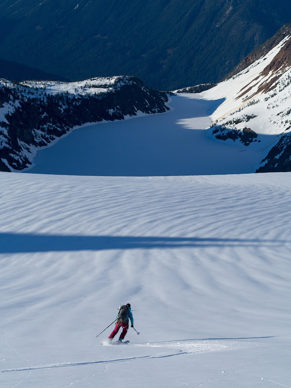
We ate dinner on the glacier east of Klackarpun and lounged in the late evening light. As the shadows approached we put our boots back on and shuffled up to the next ridge as the night engulfed us.
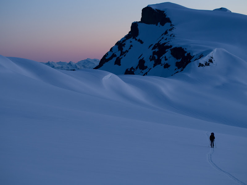
We had to position ourselves for tomorrows low elevation south and east facing BS. In the dark and our tired state we dropped over the wrong part of the ridge and got to ski steep boiler plate ice above 1000m + of exposure. We traverssed through a small rock band part way down and gained the correct slopes. The hard conditions and big terrain convinced us to skin directly up slope to a ridge crest in order to make camp. We set up camp on the windiest part of the ridge and slept for a few hours.
Another sunrise and some fast and hard morning turns.
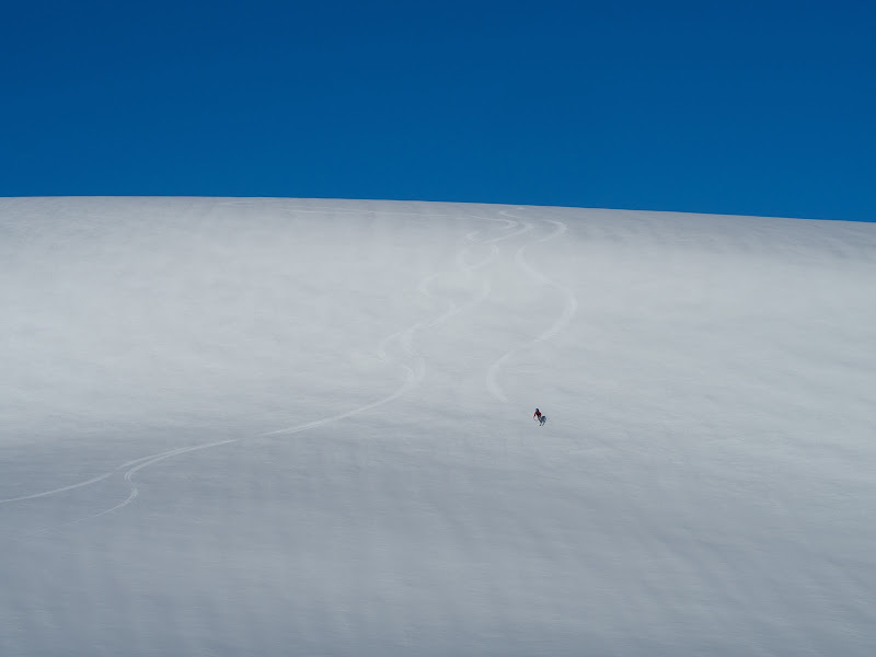
We vetoed my foolish idea (created at a computer weeks before) for a complex ridge traverse and opted for perfect corn on ESE facing slopes at 9:30am

We descended corn almost all the way down to the 1600m valley. That was good! We re-hydrated and had a chance encounter with a wolverine! Neato!

We did some steep skinning to gain the series of lakes to the west of Crestline.
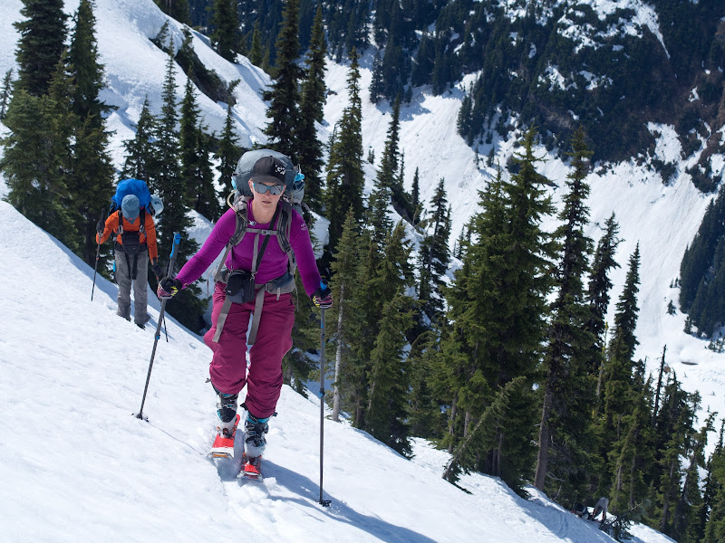
It was easy skinning in oppressive still heat so progress was slow. Someone had turned the oven up to "cleaning mode". We gained the ridge of Crestline and took a quick break. Looking at the steep east facing slope below us I muttered something about having a siesta and waiting till the sun was off of it, but this was poo-pood and after some snacks we continued along our merry way. It looks so easy to get there... other than the 1000m drop in front of us

The first bit was corn, but it slowly began to degrade as we lost elevation. This is around where it started to get questionable:
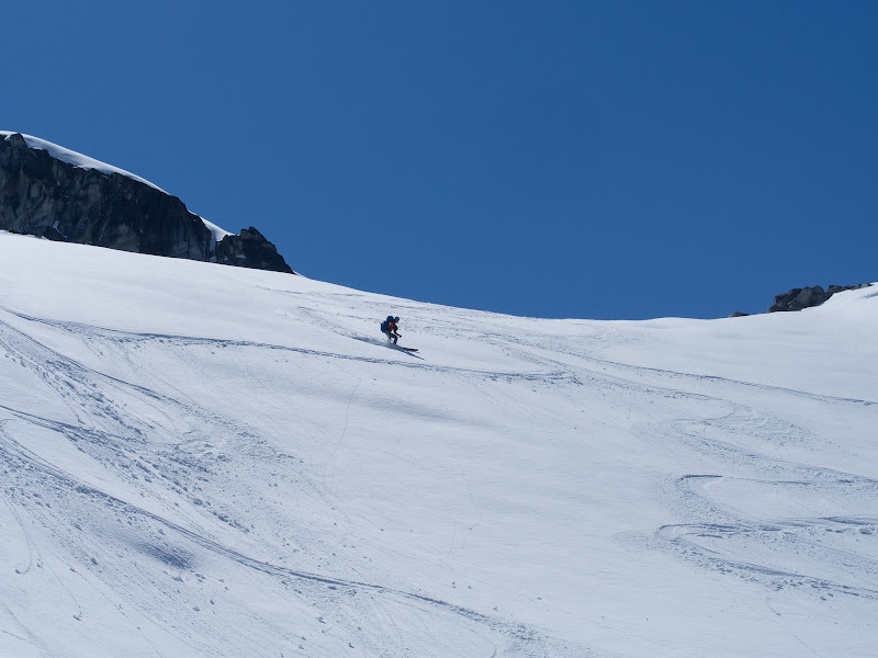
Now this is where I may bitch a bit about excessive and unnecessary GPS usage. Rich was following way points and said there was some gully we had to find. We left a small island of safety and traversed across steepening slopes and knee deep slush towards the gully. I got to the edge of the gully first. It was 45-50 degrees with a couple glide cracks and I couldn't see over a roll, but it looked like a cliff. FUCK. We reversed direction, but continued a descending traverse cutting away from the gully. We ended up trapping ourselves above 100m+ cliffs on 35 degree slopes of isothermal death slurpee. This was not a safe place to wait till the slopes cooled, so we put skins on and cautiously retraced ours steps to a moderately safe rock outcropping where the slope split in either direction. We took our siesta here and waited for several hours until the sun had completely receded behind the ridge. We skinned up a bit more and traversed over to what looked like a possible snow ramp through the cliffs.

We gained an obvious bench that did a descending traverse and crossed the gully. We skied down and shuffled over the moraine. There is ample reason to come back to this area:

We decided to call it quits at Rutledge Lake. We had wanted to camp higher up the glacier but we were all feeling a bit fried from the heat and the stress of the death slurpee. Rich went for a swim to freshen up.
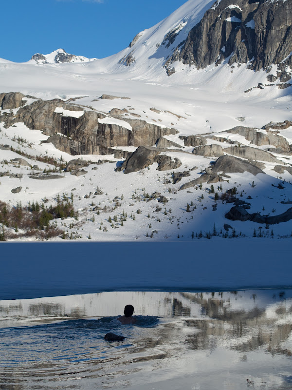
The next morning we woke up late. Maybe it was from the day before, maybe it was because it was the 4th morning of waking up at 5am or earlier followed by long days with heavy packs. Either way, the late start is the reason for failure. We knew weather was coming in, and we were too destroyed to drag ourselves out of bed at a reasonable hour. We crossed Rutledge Lake, but had to shovel snow off of the lake and build ourselves a ramp off of the ice and over the slush at the edge. Then we rambled up to the toe of the glacier and slogged up the surprisingly broken up glacier (simply because it's flat... so it was surprising how many slots there were). We walked up a few solid pieces of glacier that split the gap between the many parallel crevasses. It was easy travel, but just surprisingly close to surprisingly large holes. As we climbed, the view of Mehatl beckoned us onwards:

At the edge of the glacier we dropped our overnight gear and lightened our packs and headed for Mehatl. The weather was worsening and a storm was forecast for the afternoon / evening. We made it about 100m up the face of Mehatl before it started to rain on us. We decided to call it quits and turned around to continue along our traverse so that we could make camp somewhere other than a big open glacier. We re-packed and climbed up to the Kwoiek - Woodpile col. On the other side we saw more motivation for a future failure.

We descended all the way to valley bottom, had a siesta in the mid-day warmth and skinned up towards a small lake just south of Nielsen. The moist nature of the snow increased the glide on the sticky side of my skins and the only cure was voile straps. We spent the next 36 hours hanging out in the tent, mapsturbating, playing with sticks, and swimming.


I'll continue with the last half of the trip in a couple days. It's become obvious to me that I'm not very good at being brief...
I should also add that I was a little worried about my shoulder, as I dislocated the left one 7 weeks prior to the start of this trip. It was the first time for that side and I wanted to keep it that way.
Anyway, we started off the trip all the way down near Lillooet Lake on the Lizzie Creek FSR. Someone had carved out a new trail to bypass the washout and the shitty trail that had become the washout bypass. But the new trail quickly ended (who builds the entrance to a trail and puts up trail markers before finishing a trail?) and we descended some steep and bushy choss to gain the road. I had forgotten something at the car and had to run back without my pack, but no big deal. At least 70 pounds of gear made the road a slow slog. It also made us rather top heavy:
At some point we put our skis on and much to the surprise of no one my tele binding was already falling apart. Some swearing and bush followed
It took us 8 hours to get to the Lizzie cabin, compared to the 3 hours it took us with light packs and no skis in the summer. We pushed on towards Caltha lake and were rewarded with beautiful light on the up and breakable crust on the descent. Much fun was had.
Caltha Lake and our first camp with Petlush and Skihist way way off in the Distance
Day 2 we had a lot of distance to cover and were moving at sunrise. We contoured around into what from a distance looked like easy terrain, but instead was icy micro-terrain. We side hilled and boot packed our way over to Figure 8 Lake where we then traverssed the ridge towards Vanguard. Figure 8 Lake:
Vanguard:
We summitted Vanguard, which had a moderately steep summit slope that quickly mellowed, but then half way down the face rolled over towards a lake that used to be glacier. Not being sure of what was below the roll, we went around to a mellow gully on skiers left. Looking up, it was good we hadn't skied straight off. The steep part below the roll was a mix of rock slabs, glide cracks, and thin ribbons of isothermal mush. We crossed the lake and skinned up to a ridge where we found shelter from the heat behind a giant boulder. We took the time to have a siesta in order to allow the sun to have time to cook us even more on our next climb. We booted and skinned up the the ridge till we gained the remnants of the Skook Jim glacier, which allowed easy skinning to the ridge and then further along to the summit. Great views lead to fantastic corn turns back to our packs on the ridge where we dropped down and gaped at magnificient views of the Nahatlatch Range.
The best image to explain the next several hours is one from August. We traversed flat glaciers (from R to L) and climbed small bumps along the ridge to gain the summits of Crevasse Crag and Klackarpun.
The setting was hard to beat and the never ending view the Nahatlatch was amazing. Maddy skiing off of Klackarpun towards Elton Lake in the early evening light.
We ate dinner on the glacier east of Klackarpun and lounged in the late evening light. As the shadows approached we put our boots back on and shuffled up to the next ridge as the night engulfed us.
We had to position ourselves for tomorrows low elevation south and east facing BS. In the dark and our tired state we dropped over the wrong part of the ridge and got to ski steep boiler plate ice above 1000m + of exposure. We traverssed through a small rock band part way down and gained the correct slopes. The hard conditions and big terrain convinced us to skin directly up slope to a ridge crest in order to make camp. We set up camp on the windiest part of the ridge and slept for a few hours.
Another sunrise and some fast and hard morning turns.
We vetoed my foolish idea (created at a computer weeks before) for a complex ridge traverse and opted for perfect corn on ESE facing slopes at 9:30am
We descended corn almost all the way down to the 1600m valley. That was good! We re-hydrated and had a chance encounter with a wolverine! Neato!
We did some steep skinning to gain the series of lakes to the west of Crestline.
It was easy skinning in oppressive still heat so progress was slow. Someone had turned the oven up to "cleaning mode". We gained the ridge of Crestline and took a quick break. Looking at the steep east facing slope below us I muttered something about having a siesta and waiting till the sun was off of it, but this was poo-pood and after some snacks we continued along our merry way. It looks so easy to get there... other than the 1000m drop in front of us
The first bit was corn, but it slowly began to degrade as we lost elevation. This is around where it started to get questionable:
Now this is where I may bitch a bit about excessive and unnecessary GPS usage. Rich was following way points and said there was some gully we had to find. We left a small island of safety and traversed across steepening slopes and knee deep slush towards the gully. I got to the edge of the gully first. It was 45-50 degrees with a couple glide cracks and I couldn't see over a roll, but it looked like a cliff. FUCK. We reversed direction, but continued a descending traverse cutting away from the gully. We ended up trapping ourselves above 100m+ cliffs on 35 degree slopes of isothermal death slurpee. This was not a safe place to wait till the slopes cooled, so we put skins on and cautiously retraced ours steps to a moderately safe rock outcropping where the slope split in either direction. We took our siesta here and waited for several hours until the sun had completely receded behind the ridge. We skinned up a bit more and traversed over to what looked like a possible snow ramp through the cliffs.
We gained an obvious bench that did a descending traverse and crossed the gully. We skied down and shuffled over the moraine. There is ample reason to come back to this area:
We decided to call it quits at Rutledge Lake. We had wanted to camp higher up the glacier but we were all feeling a bit fried from the heat and the stress of the death slurpee. Rich went for a swim to freshen up.
The next morning we woke up late. Maybe it was from the day before, maybe it was because it was the 4th morning of waking up at 5am or earlier followed by long days with heavy packs. Either way, the late start is the reason for failure. We knew weather was coming in, and we were too destroyed to drag ourselves out of bed at a reasonable hour. We crossed Rutledge Lake, but had to shovel snow off of the lake and build ourselves a ramp off of the ice and over the slush at the edge. Then we rambled up to the toe of the glacier and slogged up the surprisingly broken up glacier (simply because it's flat... so it was surprising how many slots there were). We walked up a few solid pieces of glacier that split the gap between the many parallel crevasses. It was easy travel, but just surprisingly close to surprisingly large holes. As we climbed, the view of Mehatl beckoned us onwards:
At the edge of the glacier we dropped our overnight gear and lightened our packs and headed for Mehatl. The weather was worsening and a storm was forecast for the afternoon / evening. We made it about 100m up the face of Mehatl before it started to rain on us. We decided to call it quits and turned around to continue along our traverse so that we could make camp somewhere other than a big open glacier. We re-packed and climbed up to the Kwoiek - Woodpile col. On the other side we saw more motivation for a future failure.
We descended all the way to valley bottom, had a siesta in the mid-day warmth and skinned up towards a small lake just south of Nielsen. The moist nature of the snow increased the glide on the sticky side of my skins and the only cure was voile straps. We spent the next 36 hours hanging out in the tent, mapsturbating, playing with sticks, and swimming.
I'll continue with the last half of the trip in a couple days. It's become obvious to me that I'm not very good at being brief...